By Kim Nilsen
Picture this: It’s mid-August. And it’s bloody hot. It hasn’t rained appreciably for weeks. And you are in the Kilkenny division of the White Mountain National Forest and you’re running low on water. In fact, you drank your last drop. Life is hard!
While finding water is usually no problem throughout the length of the Cohos Trail, there are sections of trail where locating water is a real problem in bone dry summers. And you’re in the Kilkenny and parched. What to do?
Tank up. That’s what you do. You will need at least two liters of water entering the Kilkenny from the south or north. We’ll begin in the south. You are northbounding. There is a very reliable source of water high on Mt. Starr King, about 15 or 20 minutes from the summit. A spring weeps just off the trail to the left. It is marked by a sign. Fill you water bottles to the brim there. There will not be reliable water on the trail for many many miles.
Climb Waumbek and run over South and Middle Weeks. Fairly low on the ascent of Mt. Weeks, watch the trail and on your right (left if southbounding) for signs of moisture. There is a weak spring off the trail a short distance. Most years there is at least some trace of water there. You may have to prop you bottle up for half an hour to fill it, but water is water. During the driest of summers, this spring does dry up.
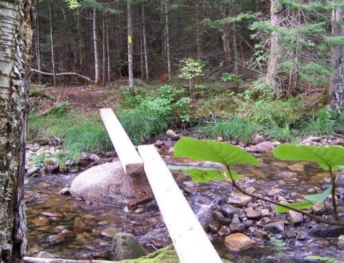
Now your work begins. Climb over Mt. Weeks and descend all the way into Willard Notch and reach the junction of the York Pond Trail. Turn right (left if southbound) down that path for as much as half a mile until you come upon the stream that drains the valley. Fill up.
Climb over Terrace Mountain and descend to Bunnell Notch. If you are in doubt about your water supply here, turn right (straight ahead if southbound) onto the Bunnell Notch Trail and descend that path until you reach the stream that drains that realm of the Kilkenny.
Now climb Mt. Cabot. There is no water at the cabin on Mt. Cabot. However, there is a spring quite a ways away but it is very difficult to find. The true summit of Cabot is a quarter mile uphill at least. Two thirds of the way along, there is or at least there was a sign on a tree indicating the direction to the old spring that served the watchman’s cabin. There was once a footpath downhill some 400 or more feet to the spring, but that path has long since been obliterated by forest debris and blowdowns. Old surveyor flags are long gone. So finding the spring is a nasty chore. If you are game to try, descend eastbound in moderately steep terrain. Travel far longer than you think is reasonable and keep scanning the terrain at your feet. The lay of the land should be relatively level side to side but always pitching downhill. Unless you actually stumble on the tiny spring itself, you are more likely to find its location by moving beyond it and noticing moisture in the soils. If you discover any damp ground, backtrack uphill to the water source.
If you are running low on water at the Mt. Cabot cabin and you are northbounding, take comfort in the fact that Unknown Pond is only a few hours away, mostly downhill. Once beyond Mt. Cabot, your chances of having water problems moderates considerably. Unknown Pond and Kilback Pond await, as do several small brook crossings, the drainage from the Devil’s Hopyard and South Pond Recreation Area. If you’re southbounding and reach Mt. Cabot Cabin with a low water supply, your struggles are just beginning.
There are other sections of the trail, too, where water can be sparse in high and dry summers. The Davis Path can be a challenge. The Gadwah Notch Trail/Kelsey Notch Trail can dry down to nothing under the worst summer conditions. Just be cautious and be smart. Always fill your water bottles at any water source you find when the heat is on and the terrain is far more thirsty than you are. And always filter water in the heat of summer. Never fail to do so. Giardia is no joy to contract or get rid of.
Hydration is salvation. It is better to have to pee too often than to die of thirst. Two liters, remember. Nothing less. And have a great hike.