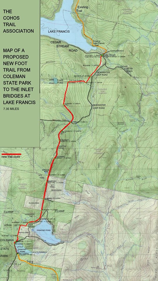
From Kim Nilsen:
Here’s an updated map of a proposed new trail directly north out of Coleman State Park in Stewartstown to the easternmost inlets to Lake Francis in Pittsburg.
Bushwhacked quite a bit of the route and road walked all the way back in about 13 hours. I’m happy to report I’m still alive. I don’t recommend the bushwhack. Old logging cuts have a way of making passage a bit less than pleasant.
Cursed the deer flies quite a bit. Fell hard just once. Missed Carr Pond, much to my navigational shame. And I’ll probably lose a body part: my little toenail on my right foot.
But the view from a third of the way north was well worth trek: South Ridge, Cedar Mountain, Whipple Ridge, Magalloway Mt., Diamond Ridge, a bit of the top of Stub, and the boundary mountains on the Canadian border. Fine vista, I must say. Interesting black spruce bog at the foot of Whipple Ridge, too.