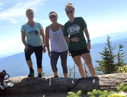
By Kim Nilsen
Each year now, The Cohos Trail Association (TCTA) has to produce an Annual Work Plan for the State of New Hampshire. In the paragraphs below, we shed light on what we have introduced to the state for possible projects on state lands and state easements in 2020. Here’s a breakdown.
MT. COVILL TRAIL BOG BRIDGES
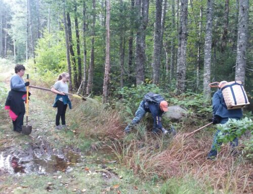
TCTA anticipates carrying out a trail maintenance project by installing a short series of four or five 10-foot bog bridges near the southeastern trailhead of the Mt. Covill Trail in northern Pittsburg, which originates (on that southeast end) at the terminus of the Round Pond Brook Road. Because the area is a bit moist and had been impacted by logging six or seven years ago, the trail in that area needs a firmer footing to protect the soils and make hiking through there a more satisfactory experience.
The association will obtain the necessary pressure-treated timber materials and pay all costs associated with the project and install the puncheons within a single day. The tops of these puncheons will be outfitted with chicken wire so that they are not slippery in wet or icy weather.
GADWAH NOTCH BOG BRIDGES
The most ambitious project slated for 2020 is the replacement of a dozen or more deteriorating 10-foot hewn log bog bridges in the remote Gadwah Notch location at 3,000-foot elevation on the northwest flank of Mt. Muise in the northern reaches of the Nash Stream Forest.
In order to carry out this project, we will need to access and open to the so-called Headwaters gate at Mile 11 on the Nash Stream Road and ferry via pickup truck materials to the high mountain meadow known as Muise Bowl. There the materials will have to be dropped at the end of the access lane and the materials hand carried about three-quarters of a mile to the notch.
Once in the notch we will disassemble the rotting log puncheons, pile them in two separate locations out of the trail corridor, and assemble all new pressure-treated timber puncheons in a long string. The puncheons will then be outfitted with chicken wire on the tops so that the spans afford a non-skid surface.
This project has to be carried out in a period of extended dry weather, most likely in August or September so that the old access lane into Muise Bowl is dry and stable.
This bog bridge string is in one of the more remote locations on the entire Cohos Trail. The project should be carried out so to improve safety moving through that remote notch.
DEER MOUNTAIN FIRETOWER TRAIL EXTENSION (RESTORATION)
This project concept was incorporated into the five-year plan for the Connecticut Lakes Headwaters Working Forest (CLHWF). This idea calls for creating a full loop hike over Deer Mountain (five miles south of the Canadian border) by linking the existing Deer Mountain Firetower Trail with what would be a newly restored former and long-abandoned jeep lane that once provided access to the Deer Mountain firetower watchman’s cabin not far below the summit where the firetower once stood (its steel infrastructure is still in place).
To be sure, this is a restoration project. We would be creating new trail atop an existing way that has been obliterated to a great degree by forest debris and logging over the course of half a century.
The project would begin at the base of the existing steel firetower infrastructure on the summit and drop down a short distance to the site of the watchman’s cabin. There the new trail would simply be a brushout project, wherein we clear out all forest debris, cut blowdowns and leaners out of the route, blaze the trail and sign it, as well. The trail would fall down the northeast flank of the mountain directly to Sophie’s Lane, the main access lane into the region that is in the Connecticut River Valley.
What this restoration would do is create a three-mile loop trail near the vicinity of Deer Mountain State Campground. Inside of the hike up the mountain being just an up and back experience, the footpath would become a true loop hike when coupled with Sophie’s Lane in the valley.
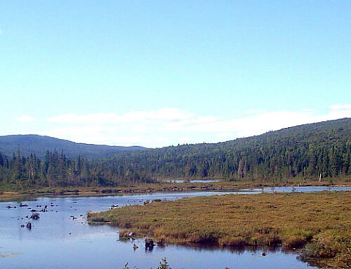
People who would like to climb the mountain would walk Sophie’s Lane a short distance to the existing Deer Mountain Firetower Trail and climb the southeast flank of the mountain the two miles to the summit and there tower there. Then, instead of backtracking, the visitor could then move northeastward on the new extension, pass the remains of the watchman’s cabin and drop a long mile downhill to Sophie’s Lane. Once there, the hiker would turn right (south) and follow Sophie’s Lane back to Deer Mountain Campground, moving along near the Moose Flowage wetlands while drifting south.
We do not anticipate needing to build any trail infrastructure in this old existing way. We would provide all the labor, blaze paint, and standard trail signage for the project at no expense to the state. We would take care of this new trail as we are caring for the existing trail on the southeast flank of the mountain.
This project would serve two distinct purposes. It would increase the recreational opportunities for overnight visitors to the Deer Mountain State Campground, providing a beautiful trek in remote country. This new pathway would also make it possible for hikers on the 170-mile Cohos Trail route to get off Sophie’s Lane for nearly two miles.
NASH STREAM BOUNDARY WALK
The Cohos Trail Association is seeking permission to simply walk (bushwhack) the existing Nash Stream Forest boundary line/Columbia township town line, in the northeastern most segment of the Nash Stream Forest to determine the feasibility of creating a much-needed bypass trail of the Kelsey Notch Trail (ATV) and Reliable Energy wind farm access road (also ATV).
This boundary walk would commence on the existing Kelsey Notch Trail (part of the Cohos Trail) where the trail crosses the Nash Stream Forest boundary/Columbia township line. The walk would then leave the trail almost due north and follow the boundary downhill several thousand feet to where it crosses the Kelsey Notch Road (ATV route). The walk would then continue nearly due north more than 2,000 feet to a boundary pin. The walk would then turn 90 degrees to the right (east) and follow that boundary a short distance to yet another pin. There the walk on boundary line would cease. Our plan is to continue due east on Wagner timberland about 2,000 feet to the existing Dixville Bypass Trail (part of the Cohos Trail) on the west flank of Dixville Peak.
This walk we deem necessary to learn the true nature of the terrain we would be moving through. We have some idea in spotty locations, but we do not have a full understanding of the nature of the forest along the full length of the boundary.
It is our intent, then, to create a full-fledged plan for the state to consider for the 2021 season. We are adamant about getting off nearly a mile and a half of ATV trail so that both ATV riders and hikers will be safer simply by not being on the same trails.
It is our understanding that the boundary is blazed with state blue paint and with Columbia township markings. We do not anticipate having to mark or flag the route unless some blazes are missing.